Strongest winds of #HurricaneMatthew are moving into Charleston, SC now. Track the storm here - http://cnn.com/hurricane
Saturday, October 8, 2016

Friday, October 7, 2016
// Mattrew // Daytona and Charleston, SC Will Get The Eye Wall //
- The worst of Hurricane #Matthew will continue for at least 18 more hours. Daytona Beach to Charleston SC will get the eyewall.
 Eric Holthaus
// Hurricane Mattrew // Be Safe Friends //
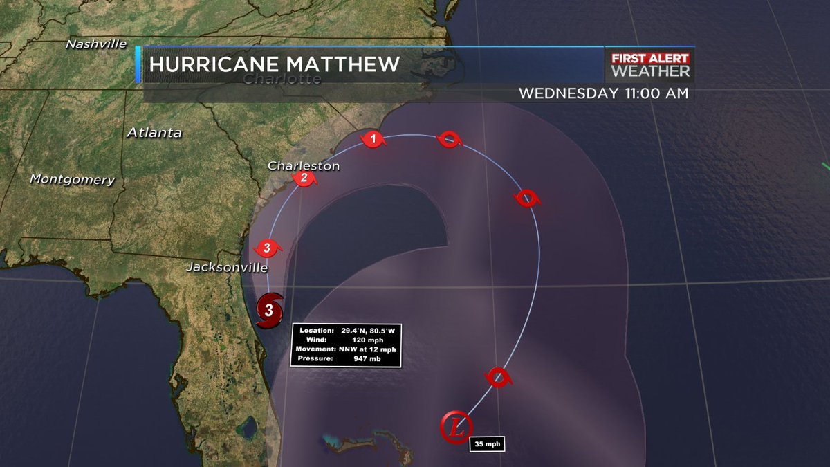
- Eye of Hurricane #Matthew is now 35 miles E/NE of Daytona Beach, moving N/NW at 12 mph. Track & timing map below.
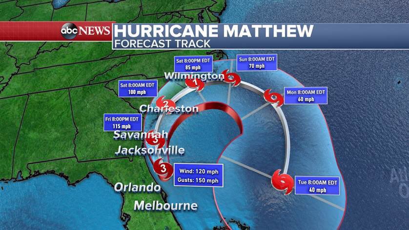
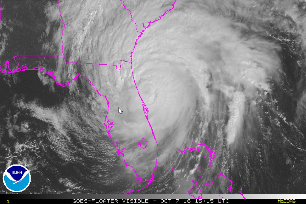
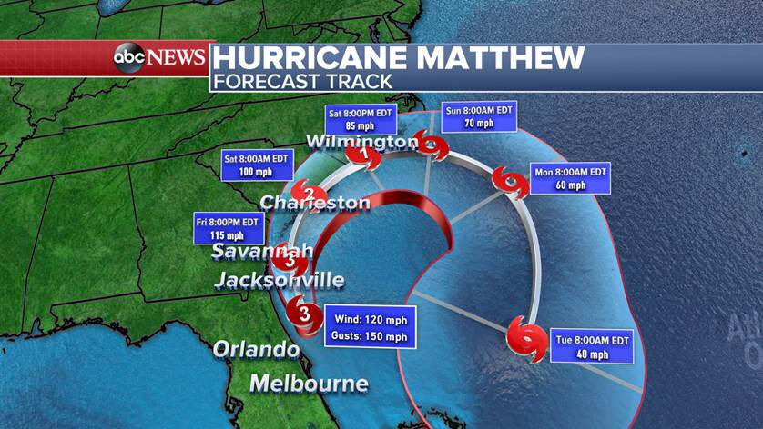
- Category 3 Hurricane #Matthew with 120mph winds skirting the FL coastline. Strongest winds just offshore for now, watching track closely.
- The eye of Hurricane #Matthew 's is now 35 miles E/NE of Daytona Beach, moving N/NW at 12 mph. Track & timing:
- #Matthew not making the turn to the East as expected. NHC has adjusted track more North. http://www.nhc.noaa.gov/graphics_at4.shtml?5-daynl#contents …
- Winds from #Matthew's eyewall are battering parts of the FL coast. Here's the latest track...





// Key messages from the latest @NHC_Atlantic discussion on Hurricane Matthew //
Key messages from the latest @NHC_Atlantic discussion on #Matthew.

Subscribe to:
Posts (Atom)